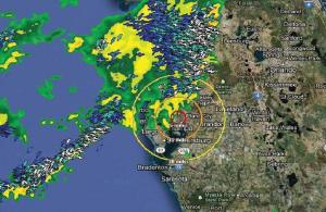
Integrating weather and GIS data for more accurate threat assessments.
Matt Zimmerman is a product manager at Schneider Electric. He is responsible for a portfolio of software ranging from outage management to line design and structural engineering. Don Leick is a senior product manager at Schneider Electric and is responsible for all aspects of the energy weather products. Don has more than 30 years experience in software and technology companies, the last 20 in product management.
Military commanders would love to have confirmed intelligence on when and where their enemy will attack so they can prepare defenses and call up reinforcements to ensure they're fully prepared to stop the attack and minimize casualties. But the when and where only paints a general picture - to best prepare, commanders need information on how strong the attack will be, what kind of weapons the enemy will use and specifics on their tactics.

Utilities preparing for a severe weather event are no different than those military commanders. They need the most reliable, detailed information to ensure enough field teams are available and positioned at the right time and place to respond quickly and efficiently to damage and outages. However, most utilities are only getting a general intelligence update from their solutions.
Advanced weather forecasting services have supported weather response planning for years, giving utilities increasingly accurate information on when and where a storm will hit, as well as storm strength.

